

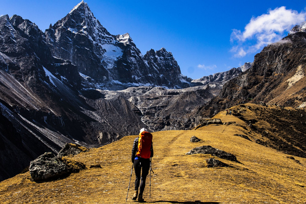
Denver’s Best Hiking Trails:
The top rated Hiking Trails in Denver, CO are:
- Highline Canal Trail – is one of the longest and most spectacular linear parks in the nation
- Smith Road Trailhead – is a nearly 14-mile public trail and natural area located in the northeast Denver
- Prairie Gateway Open Space – offers a 2.4-mile soft surface perimeter trail and overlook area with mountain views
- Rocky Mountain Arsenal – is 15,000 acres trail and features three lakes that are home to over 300 species of wildlife
- Weir Gulch Park – is a 12.9 kilometer lightly trafficked out and back trail in Denver
Highline Canal Trail
Highline Canal Trail is one of the country’s longest and most beautiful linear parks. The High Line Canal and adjacent route, which spans 71 miles from Waterton Canyon to Green Valley Ranch, just south of Denver International Airport. The asphalt, concrete, and soft surface gravel trail meanders through rural, urban, and suburban Denver and Aurora, zigzagging, bending, and zagging. The historic trail, an old ditch rider’s road, is reasonably flat and easily navigated by walkers, runners, hikers, and cyclists, falling only 200 feet over its whole length.
A portion of the trail is also suited for horseback riding. The Canal, as one of the country’s longest continuous urban paths, twists across Colorado’s most densely populated area, passing through different and diverse towns. Over 350,000 people live within a mile of the Canal, and current data shows that over 500,000 people use it as a recreational asset each year.
Products/Services:
Hiking, Biking, Walking
LOCATION:
Address: Denver, CO 80224
Phone: (720) 767-2452
Website: www.highlinecanal.org
REVIEWS:
“Take a walk in this canal and you will be walking forever. It’s beautiful and you see people all over. Close to parks and stores in case you get thirsty. During spring and fall, the colors are beautiful. Dog walking, bike riding, or just a stroll. I recommend this canal.” – Daniel A.
Smith Road Trailhead
Smith Road Trailhead is a gem in Denver’s trail network, which has made it a national model for connected trail networks. The High Line Canal in Aurora, Colorado, and the South Platte River Greenway in Commerce City are connected by this 14-mile public greenway. It runs through northeast Denver and the new Stapleton neighborhood along the route. Every day from sunrise to sunset, the Sand Creek Regional Greenway is available to the public. The trail is open to runners, walkers, nature viewers, horseback riders, and leashed dogs. They encourage you to get acquainted with the urban wilderness.
Products/Services:
Hiking Trail, Horseback Riding, Walking
LOCATION:
Address: Sand Creek Regional Greenway, Denver, CO 80239
Phone: (303) 468-3263
Website: www.sandcreekgreenway.org
REVIEWS:
“Nice biking or hiking trail so close by Central Park development. Had a short but beautiful ride and love coming back. Looks like more commercial development will be coming soon.” – Hugh W.
Prairie Gateway Open Space

Prairie Gateway Open Space is located to the northeast of the Commerce City Civic Center. The property has a total area of 190 acres. A 2.4-mile soft-surface perimeter trail, shelters, benches, and a mountain-view overlook are among the park’s main attractions. The park is always open to the public, and there is a sheltered area that can be rented.
Products/Services:
Hiking Trail
LOCATION:
Address: Prairie Pkwy, Denver, CO 80239
Phone: (303) 289-3763
Website: www.c3gov.com
REVIEWS:
“A few miles of packed rock running/biking trails. Great place to get off of the city streets but not go too far from Denver to get a good morning run. A good amount of automobile parking by trails. Does have a restroom.” – Jonathan E.
Rocky Mountain Arsenal
Rocky Mountain Arsenal is a 15,000-acre contains three lakes that are home to over 300 kinds of wildlife. There are a number of paved, boardwalk, and gravel trail alternatives available, each with a different length and difficulty level. At the north end of the trail, there is at least one allocated accessible parking place in the paved parking area off of Lake Mary, Lake Ladora access road. It has striped access aisles and is van-accessible. The trail is normally at least 4 feet wide and is either paved or packed gravel. Most trail users in wheelchairs/mobility equipment or strollers will be able to navigate this trail.
Products/Services:
Hiking Trail
LOCATION:
Address: Ladora Loop Trail Access, Denver, CO 80239
Phone: (303) 289-0930
Website: www.fws.gov
REVIEWS:
“Get your steps in. Lake Ladora and lake Mary walking loops are great places for crisp views of the Denver skyline and snow-covered front range mountains from a prairie-like setting. Lots of birdlife and waterfowl to be seen. Wide-open views of the big sky. Best enjoyed in fall, winter, and spring.” – David B.
Weir Gulch Park
Weir Gulch Park is a 12.9-kilometer out-and-back trail with a river that is suitable for all skill levels and is located near Denver, Colorado. Walking, running, road riding and mountain biking are the most popular activities on the trail. This trail is also allowed to pets, though they must be kept on a leash. Weir Gulch runs from west Denver to the Lakewood boundary, cutting a narrow, jagged course through the topography. A greenway walk follows the stream’s flow, looping from the Platte River Trail’s edge southwest through Barnum Park and the communities of Barnum, West Barnum, and Westwood.
Products/Services:
Hiking Trail
LOCATION:
Address: 2620 W 9th Ave, Denver, CO 80219
Phone: (720) 913-1311
Website: www.denvergov.org
REVIEWS:
“I’ve lived by this place my whole life and this park is really extensive and fun to bring the kids for a bike ride. this is a really good park if you want to explore or if you just want to play basketball or use a playground because if you follow the creek westwards from I-25 you will stumble on many different playgrounds and picnic areas that are perfect for spending more time with your family.” – Javier M.

Mark has lived in Detroit, MI his whole life. He has worked as a journalist for nearly a decade having contributed to several large publications including the Yahoo News and True Dakotan. As a journalist for Kev’s Best, Mark covers national and local businesses.